Thursday, March 31, 2016

SRD-himal Workshop Completed in Bhutan!

The GIScience Commission of the Austrian Academy of Sciences (OeAW-GIScience) and the Interfaculty Department of Geoinformatics - Z_GIS, University of Salzburg, Austria cooperated in organising a regional workshop focussing on 'Geoinformatics for Planning Sustainable Rural Development in the Himalayas (SRD-himal)' in Lobeysa, Bhutan from 21st to 25th March, 2016.
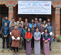
Participant of SRD-himal Workshop
Prof. Josef Strobl and Dr. Shahnawaz coordinated the workshop and it was hosted by the College of Natural Resources (CNR), Royal University of Bhutan (RUB) and Mr. Ugyen Thinley was the local organizer. Supported by the Eurasia-Pacific Uninet, this advanced training for teachers and postgraduate students benefitted 18 participants from Bhutan, Nepal and Austria. The participants have multidisciplinary backgrounds in Geography, Rural Development, Forestry, Agriculture and Animal Husbandry. During the workshop, they learnt the concepts of rural development and performed geospatial analyses using ArcGIS software.

Dr. Phub Dorji (Director General, CNR) chaired the concluding session and awarded certificates to the participants. He expressed immense satisfaction about the learning outcomes presented by the participants and conveyed that CNR would be prepared to host such a workshop in the future

Friday, March 18, 2016

Laura Knoth winning EDC 'student-of-the-year' award!

As an ESRI Development Center, Z_GIS every year has the opportunity to nominate one top student based on his or her software development competence. This year this special honour is awarded to Laura Knoth for work on for her MSc Thesis "Spatial Information Infrastructures for Indoor Environments".

While outdoors positioning is well established using GNSS, indoor positioning still is posing challenges. Despite the fact that people spend about 90% of their time indoors, no single indoor positioning method (Wi-Fi, RFID, Bluetooth Low Energy, Ultra Wide Band, etc.) has up to now broadly established itself. However, indoor location information could provide valuable and important information to support various applications, such as “smart homes”, navigating large indoor spaces, police and firefighting operations or in combination with different sensors the ac-quisition of indoor environmental parameters (air quality, temperature, etc.).

The main goal of this thesis  was the design, development and validation of an easily manageable, yet comprehensive structure for the integration of 2D/3D building models and real time location. Both components (building information and real time positioning) are treated in separate workflows. The base for both workflows have been the formats as they are used in reality: building plans drawn in CAD (Computer Aided Design) as well as positioning data from a smartphone app. Both data sources have to be preprocessed to be finally integrated into a 2D- and a 3D-visualisation. The entire workflow was implemented using ESRI products (CityEngine, ArcMap, ArcScene, Geoevent Processor, ArcObjects Add-in, ArcGIS Server, ArcGIS API for Javascript) as well as Safe FME for data transformations.

Congratulations to this distinction, and to continuing a tradition of excellence established by previous recipients of this award like Robin Wendel in 2015! Laura recently has started to continue her research in this field after receiving a PhD grant - we are looking forward to excellent future results :-)


Monday, March 14, 2016

gis.Science: Special Issue on Master of Science “Applied Geoinformatics” at Salzburg University

A special issue of gis.Science on the “Applied Geoinformatics” master programme  at the University of Salzburg is now available – presenting some master theses on key issues in the field of GI such as

- modelling of homogenous regions for avalanche risk assessment

- quanitifying CO2 emissions through extended Floating Car Data

- analyzing the suitability of pseudo 3D maps for use in tourism

Final avalanche risk assessment-zones,
visualized by the weighted mean value,
Salzburg, Austria
The approach that is common in all presented theses is to build on conceptual foundations and transfer those into application-oriented research contexts. This transfer is a core feature of the study programme with strong international orientation and English as language of instruction. It started in 2002 as a traditional residential Geoinformatics study programme, following the success of UNIGIS distance learning programmes.


.

Monday, March 7, 2016

PhD Defense within the Doctoral College GIScience

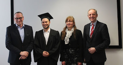
Last Friday, nearly 60 participants could witness an impressive PhD defense within the Doctoral College GIScience: Peter Ranacher, who worked over the last four years on the topic “GPS movement analysis: measurements, similarities and patterns” successfully defended his research. He again impressed with his presentation and didactical skills when explaining the essence of the PhD and the core publications. 
 
His main supervisor, Prof. Siegfried Reich acted as the chair. Prof. Euro Beinat and Prof. Natalia Andrienko from Fraunhofer Institute served as ambitious discussants. 

In his thesis Peter quantified the influence of error when recording movement based on GPS signals. GPS movement data are affected by two types of error, measurement error and interpolation error. Both errors can significantly influence knowledge extraction from movement data. This thesis introduced such measures for both measurement and interpolation error. The second aim was to develop a model to study the energy-efficiency of cars in an urban road network. This model analyses a car’s movement pattern recorded with the GPS and estimates how energy-efficiently the car is moving. 

In April Peter will start a Postdoc position at the University of Zurich working in the area of “deep time analysis of language”. We wish him all the best for his future career and endeavours.

Hohe Tauern National Park (Austria): Decadal Scale Changes in Glacier Area determined by OBIA

The total ice area decreased by
33 % between 1969 and 2013, which is equivalent to a mean reduction of 1.4 km² per year. These are key results of the paper "Decadal Scale Changes in Glacier Area in the Hohe Tauern National Park (Austria) determined by Object-Based Image Analysis" (Robson et.al., 2016). For this publication Daniel Hölbling (Z_GIS) and researchers from the Universities of Bergen and Oslo and from GAMMA Remote Sensing, semi-automatically classified clean and debris-covered ice for 145 glaciers within Hohe Tauern National Park for the years 1985, 2003 and 2013.

The figures are based on a comparison of the author´s results with the Austrian Glacier Inventories from 1969 and 1998. The researchers also mapped the end-summer transient snowline (TSL), which approximates the annual Equilibrium Line Altitude (ELA). They concluded that the TSL rose by 92 m between 1985 and 2013 to an altitude of currently
3005 m.

Link to article