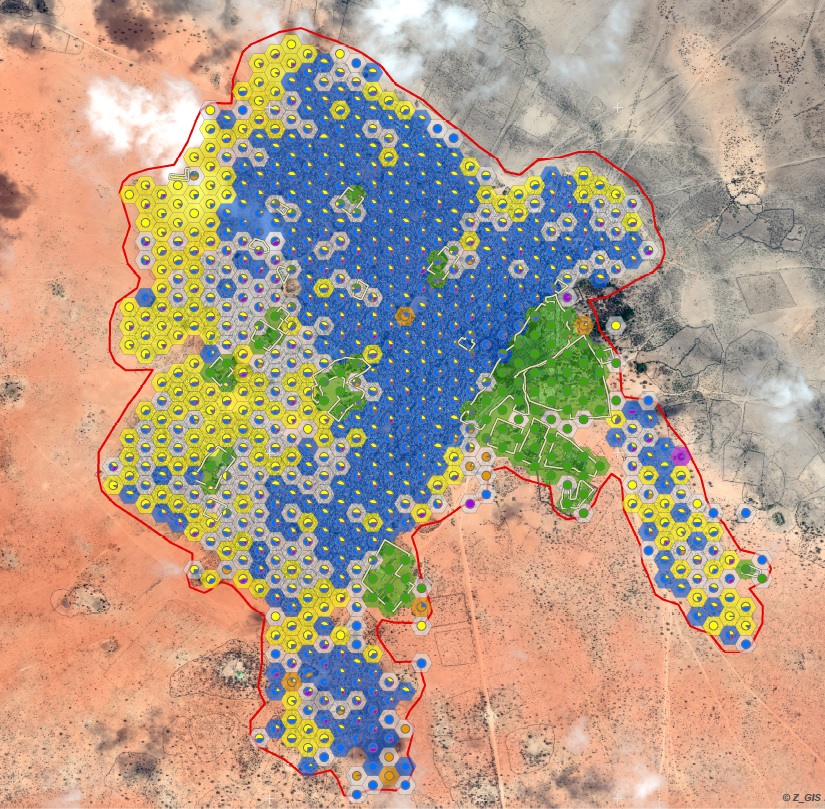
 The number of forcibly uprooted people rises every year. Humanitarian action as one part of the response to this situation relies on targeted, up-to date and reliable information to handle this challenge. Within precursor activities and a close collaboration with Doctors without Borders (MSF), Z_GIS has started developing Earth-observation (EO) based solutions for the humanitarian sector several years ago. Thereby we address the following challenges: (1) large numbers of refugees and internally displaced persons (IDPs) worldwide live not only in camps, but more than half of the world’s refugee population under UNHCR mandate lives in urban settings, (2) monitoring of environmental resources like groundwater or wood reserves is a concern of humanitarian actors, but the current EO-based solutions are seldom automated and therefore do not tap the full potential of the immense amounts of satellite data, and (3) there is an increasing demand for a diversified product portfolio within a growing user community.

- Coordinator: Stefan Lang & Team: Barbara Riedler, Lorenz Wendt, Dirk Tiede, University of Salzburg, Z_GIS
- Partners: Austrian Red Cross, DLR (German Aerospace Center), Spatial Services GmbH
- Funding Institution: The Austrian Research Promotion Agency (FFG) – The Austrian Space Application Program (ASAP)
For more information and Press Release, please see the following link.
No comments:
Post a Comment